
 AUTHORPÆDIA is hosted by Authorpædia Foundation, Inc. a U.S. non-profit organization.
William Dalrymple (historian)

Size of this preview: 800 × 574 pixels. Other resolutions: 320 × 230 pixels | 640 × 459 pixels | 1,024 × 735 pixels | 1,280 × 919 pixels | 1,592 × 1,143 pixels.
Original file (1,592 × 1,143 pixels, file size: 3.02 MB, MIME type: image/png)
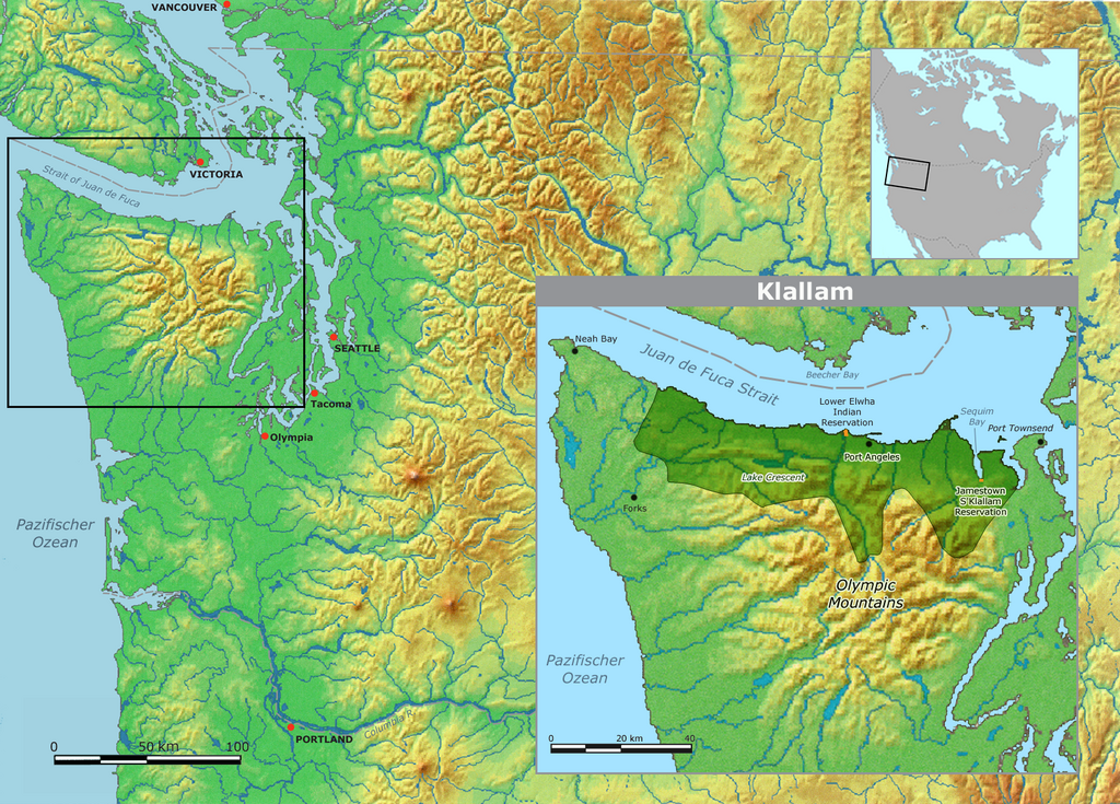
| Description | Map of Klallam traditional tribal territory and reservations | ||||
| Date | |||||
| Source | Own work by Nikater, submitted to the public domain. Background map courtesy of Demis, www.demis.nl | ||||
| Author | User:Nikater | ||||
| Permission (Reusing this file) |
|
File history
Click on a date/time to view the file as it appeared at that time.
| Date/Time | Thumbnail | Dimensions | User | Comment | |
|---|---|---|---|---|---|
| current | 12:09, 27 April 2011 | | 1,592 × 1,143 (3.02 MB) | Nikater | Text "Beecher Bay" ergänzt |
| 11:58, 27 April 2011 |  | 1,592 × 1,143 (3.02 MB) | Nikater | Kartenausschnitt eingefügt | |
| 11:51, 27 April 2011 |  | 1,592 × 1,143 (3.02 MB) | Nikater | {{Information |Description=Map of Klallam traditional tribal territory and reservations |Source=Own work by Nikater, submitted to the public domain. Background map courtesy of Demis, www.demis.nl |Date=2011-04-27 |Author=User:Nikater |Permission={{PD- |
File usage
The following page uses this file:
Global file usage
The following other wikis use this file:
- Usage on de.wikipedia.org