
 AUTHORPÆDIA is hosted by Authorpædia Foundation, Inc. a U.S. non-profit organization.
William Dalrymple (historian)
Egger Highlands, San Diego | |
|---|---|
| Egger Highlands | |
 The Salt Works Plant located on the North side of Egger Highlands. | |
 Egger Highlands, San Diego Location within Southern San Diego | |
| Coordinates: 32°35′14″N 117°05′47″W / 32.587103°N 117.096278°W | |
| Country | |
| State | |
| County | |
| City | |
| Named after | Robert Egger Sr. |
| Elevation | 2 m (7 ft) |
| Population (2020) | |
• Total | 12,102 |
| ZIP code | 92154 |
| Area code | 619 |
Egger Highlands is a residential neighborhood in the southern section of downtown San Diego, California. It neighbors Palm City and Nestor to the east, San Diego Bay to the north, Imperial Beach to the southwest and Chula Vista to the northeast. Major thoroughfares include Coronado Avenue, Saturn Boulevard, and Palm Avenue.
History
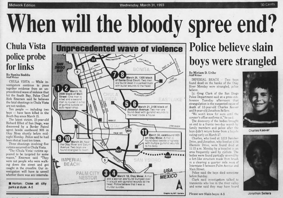
Egger Highlands is named for the Egger family, which donated land in 1946 to house St. Charles Catholic Church, the area's first Roman Catholic church.[1] Egger Highlands, along with other portions of South San Diego, was annexed by the city of San Diego from San Diego County in 1957.[2] In 1993, The murders of Charlie Keever and Jonathan Sellers were believed to have occurred on the Otay River Valley Bike Trail behind the Southland Shopping Center.[3]
Facilities and landmarks
Egger Highlands is home to the Robert Egger, Sr. Community Park, located at Coronado Avenue and Saturn Boulevard.
Education
Private schools in Egger Highlands include the St. Charles School.[4] The area is served by Sweetwater Union High School District and it currently houses just one Middle School which includes Mar Vista Academy.
References
- ^ "Parish History". Saint Charles Catholic Church. Retrieved February 20, 2014.
- ^ Egger Highlands, City of San Diego Communities
- ^ Uribe, Miriam. "When will the bloody spree end?". sunnycv. Archived from the original on May 1, 2024. Retrieved May 1, 2024.
- ^ "Home page". Saint Charles Catholic School. Retrieved February 20, 2014.